
All tour information is user generated and although we try our best, we cannot guarantee its correctness. Always consult people with knowledge about the area and get a proper map. If in doubt, hire a guide!
Val Lasties
Lift access, but still a feeling of getting away from the ski area surrounded by only mountains in Val Lasties. Follow the main tracks north-east from the cable-car and until you get to the refugio on the saddle. Then go north down into the big valley. The terrain is open, so find a suitable route of your choise down the valley. When you start reaching the trees, you might want to keep a bit left so that you can ski all the way down to the big house by the road. After that it is a bit of flat transport back to the pistes.
The closest ski resort is Canazei - Belvedere
,
2 km away.
- Created by: Robert Johansson
- Difficulty: S3 - Medium (<35°)
- Danger/Exposure: E1 - Low
- Time: 01:00 hours
- Total climb: 5 m
- Total elevation drop: 1201 m
- Length: 5.14 km
- Highest altitude: 2924 m
- Lowest altitude: 1727 m
- Slope facing: N
- Extra gear: None
- Lift access: Yes
Photos
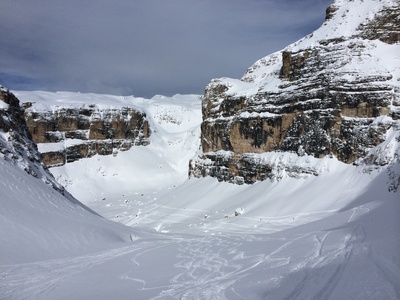
First part of the descent
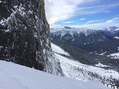
From the second part down into the trees.
Map
Public runs
No public runs yet.Elevation
Loading...
Slope
Loading...
Negative slope values means the track is heading uphill.