
All tour information is user generated and although we try our best, we cannot guarantee its correctness. Always consult people with knowledge about the area and get a proper map. If in doubt, hire a guide!
Canale Holtzer
Couloir
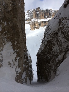
A long, steep and partly narrow colouir. If there is not large amounts of snow, there is a short section in the middle where you will need to rapell (there is an anchor that you can use). It is easy to reach from the top of the Pordoi Cablecar, no skins needed! After exiting the couloir, follow Val Lasties down past the Refugio and back to the lift system.
The closest ski resort is Canazei - Belvedere
,
2 km away.
- Created by: Robert Johansson
- Difficulty: S5 - Very difficult (40-50°)
- Danger/Exposure: E2 - Medium/High
- Time: 01:30 hours
- Total climb: 13 m
- Total elevation drop: 1206 m
- Length: 4.02 km
- Highest altitude: 2923 m
- Lowest altitude: 1728 m
- Slope facing: N
- Extra gear: Rappelling gear
- Lift access: No
Photos
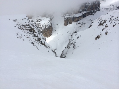
Entry into the couloir
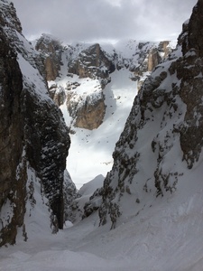
The narrow and spectacular last part of Canale Holtzer
Map
Public runs
No public runs yet.Elevation
Loading...
Slope
Loading...
Negative slope values means the track is heading uphill.