
All tour information is user generated and although we try our best, we cannot guarantee its correctness. Always consult people with knowledge about the area and get a proper map. If in doubt, hire a guide!
Forcella Sassolungo
Nice tour where the snow is often good on the descent. The way up is easy to find, you see the Refugio Toni Demetz (the highest point on the tour) is visible from the lift on the way up. It is a large open slope up, gets steeper at the last part of the climb. Down is also steepest in the beginning, followed by a flat part. After that there are open slopes and lots of space until you get down to the trees. There is a path through the trees that you should be able to find. The path leads out to the road to Monte Pana, here you can wave down the bus and get a ride to Monte Pana or follow the road a bit and then use the cross country tracks to get to the Monte Pana slopes.
- Created by: Robert Johansson
- Difficulty: S3 - Medium (<35°)
- Danger/Exposure: E1 - Low
- Time: 04:00 hours
- Total climb: 360 m
- Total elevation drop: 1105 m
- Length: 7.49 km
- Highest altitude: 2706 m
- Lowest altitude: 1627 m
- Slope facing: NW
- Extra gear: None
- Lift access: No
Photos
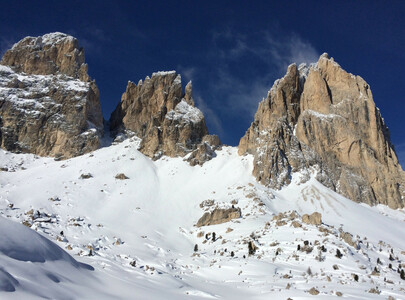
The way up
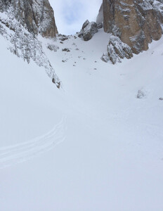
The way down
Map
Public runs
No public runs yet.Elevation
Loading...
Slope
Loading...
Negative slope values means the track is heading uphill.