All tour information is user generated and although we try our best, we cannot guarantee its correctness. Always consult people with knowledge about the area and get a proper map. If in doubt, hire a guide!
Les Deux Antoines: SE Slope
Peak
From Les Echines dessus, take the small road up towards Fort du Truc, pass it on the left sida and from there follow the ridge until you come to Fort de la Platte. Pass this fort on the left side as well and continue uphill. From here you will se the summit if the weather permits. There are cliffs on the SE side of the summit, so to reach it, go around on the right side and approach the summit from the north.
Descend the same way as you went up. At the end you can go left before Fort de Truc if you are comfortable with a bit steeper skiing with some trees. You see this area when you go up so you can inspect it then.

The closest ski resort is Les Arcs
,
5 km away.
- Difficulty: S2 - Easy
- Danger/Exposure: E1 - Low
- Time: 03:00 hours
- Total climb: 1068 m
- Total elevation drop: 1072 m
- Length: 8.66 km
- Highest altitude: 2369 m
- Lowest altitude: 1304 m
- Slope facing: SE
- Extra gear: None
- Lift access: No
Photos
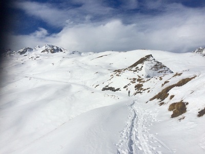
View of the summit and the way up from Fort de la Platte
Map
Elevation
Loading...
Slope
Loading...
Negative slope values means the track is heading uphill.
Public photos on this tour
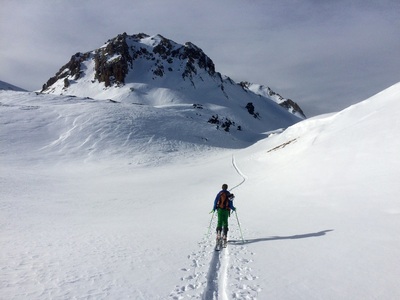
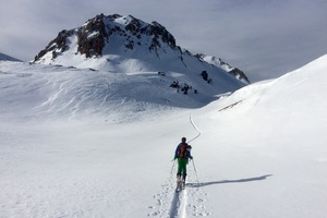
Approaching the summit